Upper Broken and Boosey Creek Regional Flood Study
- Project typeFlood Study
- Project value$270,000
- Project scheduleCommunity Consultation
- Contractor nameHARC Consulting
The Upper Broken and Boosey Creek Flood Study Project Steering Committee oversees this flood study. The committee consists of members from Community, Moira Shire Council and Benalla Rural City Council, GBCMA and Vic SES.
The objective of this project is to produce flood intelligence and mapping products for the floodplains associated within the Boosey and Upper Broken Creeks and its tributaries to some 5 kilometres downstream of the Broken Creek discharge gauging station at Katamatite.
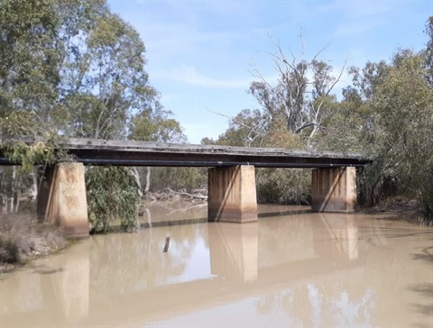
More specifically, but not limited to, the Study will determine the impacts of flooding at Katamatite, Tungamah, Wilby, Lake Rowan, St James, Devenish, Thoona and Goorambat. Mapping will be used for emergency management planning, planning schemes and Total Flood Warning Systems (which are commensurate with flood risk).
Community Conversations
HARC Consulting presented a draft calibration of the flood model to community members at three community conversation sessions held on 10 October 2022 at St James, Tungamah and Katamatite. Attendees were asked to compare the maps from the flood model of the 2012 flood event with their lived experience of the floods.
Thank you to everyone who was able to attend one of the community conversations who shared their experience of the 2012 flood extent and levels.
The consultants are now reviewing all the feedback and preparing a final version of the flood model.
Flood Study area outlined in red:

This project is jointly funded by Moira Shire Council, Benalla Rural City Council, GBCMA, SES and the Victorian Government under the Natural Disaster Resilience Grant Scheme (NDRGS).
Investigations for the Upper Broken Creek and Boosey Creek Regional Flood Study are now complete. A draft floodplain management plan is being prepared and will be presented to Council for endorsement.
For more information please visit: Goulburn Broken CMA Flood Studies Page.